
Lori and Jon:


I have noticed that the parcel represented in KGIS as immediately adjacent to First Creek is not legally defined as having a boundary immediately adjacent to First Creek as suggested by the KGIS data model for that parcel
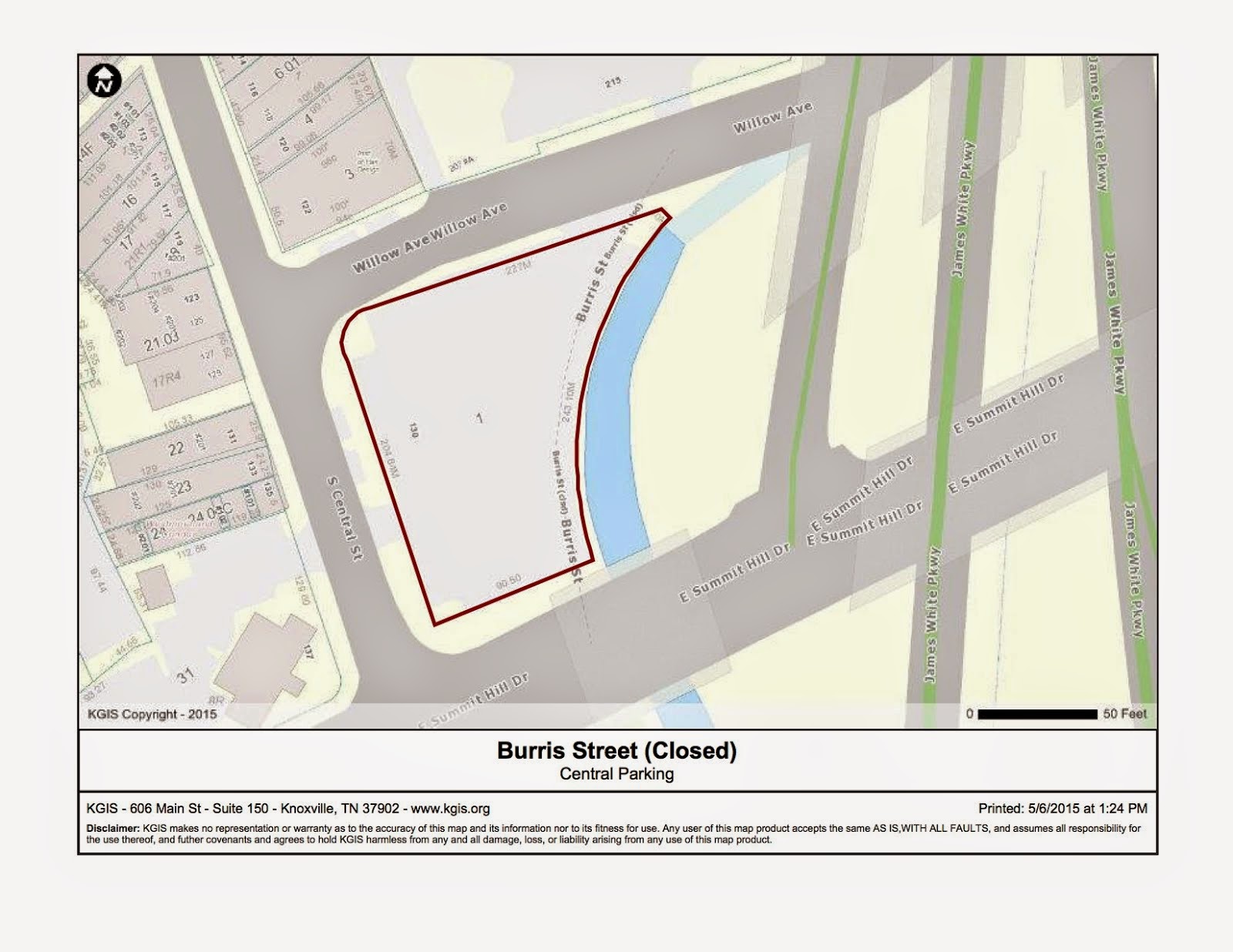
Therefore, the area adjacent to the creek on former "Burris Street" should be free to route the First Creek Greenway along it, rather than taking Willow Avenue streetside to Central.
Note the description of "Tract XV" in the attachment, "20010416006956.tif" indicates"
The property line is defined as Burris Street from Willow to Vine Avenue, which was presumably closed when Vine Avenue became Summit Hill Drive.
Today, the parking lot operator has appropriated the closed Burris street to add additional parking spaces as shown in aerial imagery acquired in 2014 and available in KGIS.

Perhaps there are "squatters rights" involved here, but so far as I can tell the formal legal description of the parcel on record with the County does not grant those rights at this time.
Therefore, I believe that the closed "Burris Street" should be reserved as part of the planned greenway connection from Willow Avenue to Central Street along First Creek.
Thanks,
Tanner
No comments:
Post a Comment