Thursday, December 31, 2015
Tuesday, December 15, 2015
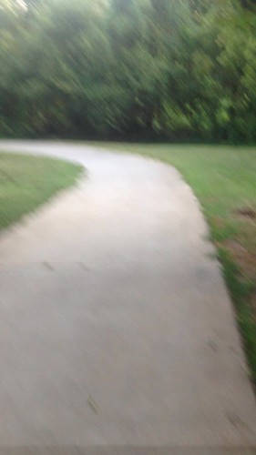
Bike lanes going in on Sevier Ave.
Bike lanes going in on Sevier! They have a buffer zone between the travel lane.
Posted by Knoxville Regional Bicycle Program on Tuesday, December 15, 2015
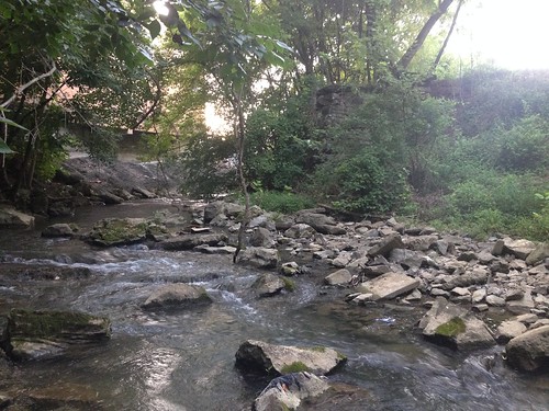
Knox/Blount Greenway Ribbon Cutting
City of Knoxville - Government
Knoxville Mayor Madeline Rogero, City Council members and regional officials this morning opened the first section of...
Posted by City of Knoxville - Government on Tuesday, December 15, 2015
Monday, December 7, 2015
City completes 2-mile section of Knox/Blount Greenway - News Sentinel Story
City completes 2-mile section of Knox/Blount Greenway - News Sentinel Story:
Much of this phase has been done since last year, but some changes pushed the completion of the final half-mile connecting to the bridge...
Inquiring minds want to know: what changes?
Concrete versus asphalt?
Thursday, December 3, 2015
Former Knoxville Mayor Ashe Weighs in on Greenway Progress
Former mayor Ashe cites greenway project as "Endlessly delayed."
Expect Pavlis to be vice mayor | Shopper-News:
I'd like to know what exactly went wrong with this project that delayed its opening so significantly?
Expect Pavlis to be vice mayor | Shopper-News:
■ The endlessly delayed opening of the Buck Karnes greenway along the Tennessee River has now been delayed to sometime before the end of the year, according to city spokesperson Eric Vreeland. Earlier greenway coordinator Lori Goerlich had said it would occur before Thanksgiving. No word on whether there will be a formal opening or ribbon cutting. The greenway itself has been completed for six months at a cost of $1.6 million but not announced by the city.Note that the Greenway will have a ribbon cutting on December 15.
I'd like to know what exactly went wrong with this project that delayed its opening so significantly?
Wednesday, November 25, 2015
Knoxville transforms from ‘scruffy’ to sleek
Trails and greenways highlighted as Knoxville attractions in Tennessean review.
Knoxville transforms from ‘scruffy’ to sleek:
Note: Knoxville prefers "scruffy" today, in the way that Ashevillians want to "Keep Asheville Weird," Knoxvillians want to "Keep Knoxville Scruffy."
Knoxville transforms from ‘scruffy’ to sleek:
Knoxville’s Urban Wilderness is a 1,000-acre corridor of forested acres and trail systems along the city’s south waterfront that invites hiking, mountain biking, swimming, paddleboarding, kayaking, canoeing, climbing, canopy tours and other outdoor activities. It incorporates several parks and natural areas, Civil War sites, and more than 40 miles of multi-use trails.
Note: Knoxville prefers "scruffy" today, in the way that Ashevillians want to "Keep Asheville Weird," Knoxvillians want to "Keep Knoxville Scruffy."
Thursday, November 19, 2015
New Investment Spurred by Planned Greenway Trail
Discover Knoxville’s Best New Bar for Outdoor Enthusiasts | RootsRated:
“The edge of [Suttree Landing Park] will be about 100 yards from here and the new G&O Trail will be right here along the railroad tracks,” says Kathy Wright, co-owner and co-founder of the Trailhead Beer Market, one of Knoxville’s best new bars.G&O Greenway Trail post.
Thursday, November 12, 2015
Loves Creek Road Pedestrian Fatality Investigation
Loves Creek Road Pedestrian Fatality Investigation On November 11, 2015, at approximately 9:05 p.m., officers responded...
Posted by Knoxville Police Department on Thursday, November 12, 2015
Thursday, November 5, 2015
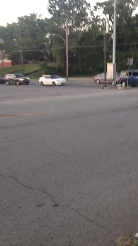
Driver of motorized scooter injured in North Knoxville crash - News Sentinel Story
Driver of motorized scooter injured in North Knoxville crash - News Sentinel Story:
The incident, near 4434 N. Broadway, was reported just before 7 p.m., according to a Knoxville Police Department news release.
The right lane of northbound traffic on Broadway had stopped in front of the Dollar Tree store to allow the driver of the scooter to cross, police said. The male entered the right lane and then crossed into the left lane of northbound traffic without checking for oncoming vehicles, when he was hit by a car, according to the release.
Thursday, October 29, 2015
Fwd: Comcast Investment in East Knox: Opportunity for Greenway Connection?
Brian and Chris:
Read on the city blog this morning that Comcast is investing in its Asheville Highway facility.
This may be an opportune time to approach the Comcast RE: a possible greenway connection from the Comcast call center to a small greenway loop / Holston river at Chilhowee Ballfields.
My hope is a connection from Comcast's Call Center to the adjacent park would raise the profile and usage of a little known and majorly neglected asset of the City's.
The city does not seem to "claim" (or maintain, apparently), the portion of the paved pathway along the river and former swimming club; however, KGIS suggests the city does own the property alongside the river. See map below, highlighting the location of the call center. Yellow arrows indicate areas of potential enhancement to the park and greenway facility.

Although the city does not own the land connecting the walking path from the greenway loop to George Bounds Road, I feel we should always advocate for partnerships with private landowners as a matter of course.
Also note there's a wastewater treatment facility south of the electric power transmission lines, possibly posing opportunities for greenway construction. The powerline right of way itself poses opportunity for greenway construction linking back to the ballfields.
The severely neglected paved path adjacent to the river offers views of the Holston River adjacent to Asheville highway bridge:
Thanks,
-Tanner
Tuesday, October 27, 2015
Strategy for Outreach to Comcast re: Possible East Knox Greenway Connection?
Hi Brian,
I have no knowledge of Comcast's potential interest, I just have wishful thinking :)
In general, I'd like to see a trend of our local businesses both asking for and supporting greenway connections.
I understand this has happened a few times - but I'm unsure there's wide understanding that the city actively works with business owners on greenway connections and easements.
I think a valuable undertaking for the commission would be to craft a strategic "recruitment message" to draw potential partners / communicate the benefits of connecting a business to a greenway.
For example, there's that often quoted metric about how "home values increase near parks and greenways."
The figure was just repeated in the new 2015 Parks and Recreation Guide.
However, there are also tangible and intangible benefits for businesses.
I know there are many articles, even scholarly journal articles, talking about how workers are happier and more productive with access to even just a few minutes of nature. Businesses should infer that greenway access for employees translates to better performance, more satisfied employees, less turnover and training.
I'd like to see something of a "toolkit" for our corporate citizens to express interest in and/or financially support greenway connections or property easements.
Concerning how to contact Comcast to gauge interest:
I found this e-mail address:
Another, more personal approach might be to see who we know that knows someone at Comcast.
For example, by using LinkedIN I found two likely prospects:
Executive vice president for the central region based in Knoxville, Valerie Gillespie:
Vice President for Government and Community Affairs out of Atlanta, Andy Macke: https://www.linkedin.com/pub/andy-macke/3/76a/670
Before trying a cold call, it might be best to see if anyone on the commission is connected to a Knoxville based Comcast manager.
Any ideas off hand? I could also send out an e-mail to our group to inquire.
-Tanner
Tuesday, October 20, 2015
First U.S. bicycle route will link Atlanta to Chattanooga | Route 666
First U.S. bicycle route will link Atlanta to Chattanooga | Route 666:
U.S. Bike Route 21 is Georgia’s first U.S. Bicycle Route designation that connects Atlanta to Chattanooga on the Tennessee border. The bike route is 160.8 miles long. The Georgia Department of Transportation has been coordinating with Tennessee to designate USBR 21, which will eventually connect Atlanta to Cleveland.
Saturday, October 17, 2015
A fresh view: Urban park nearly ready for turnover to city - News Sentinel Story
A fresh view: Urban park nearly ready for turnover to city - News Sentinel Story:
Legacy Parks bought the 69 acres on a ridge overlooking Fort Loudoun Lake and downtown Knoxville in 2009 for $1.5 million. Within the next two months, the foundation will give the land to the city, which plans to develop walking trails across the Civil War battle site.
“The bike path will be along the bottom, so this will be a passive park for people to come read a book and meander around and have the most beautiful view of downtown Knoxville and the river ever,” Pavlis said.
Wednesday, September 16, 2015
The Nature Cure Why some doctors are writing prescriptions for time outdoors
The Growing Field of Ecotherapy - The Atlantic:
But other research, conducted with actual humans, does support the idea that spending time in nature makes people healthier. Children with ADHD who regularly play in parks have been found to have milder symptoms than those who spend more time indoors, for example, and therapeutic-camping programs have been found to decrease relapse rates in substance addicts. Such findings generally have more to do with mood and behavior than basic biology—but mood and behavior are intimately tied to physical well-being. Social connection, for instance, is one of the most important factors in human health. And communal green spaces foster that.
New 3 mile "Rail With Trail" from Chapman Hwy. to Ijams
New trail to help revitalize South Knoxville:
The path, named the G&O Trail for the railway, is set to extend from the old Kern's Bakery Building on Chapman Highway - just across the Henley Bridge from downtown Knoxville - to Ijams Nature Center's Meads Quarry, connecting it to the more than 40 miles of trails there in Knoxville's Urban Wilderness.
The three-mile trail will wind through parts of South Knoxville that stand to benefit.
"It's definitely a corridor that has been vacant and underdeveloped and under-utilized," she said. "What we're going to see is neighborhoods connected, businesses connected, businesses that incubate along the rail line because people will love to sit on a patio and bike from spot to spot."
Monday, August 24, 2015
Young Girl Hit by Car on John May Drive Near Western Avenue
A young girl was hit by a car in West Knoxville on Sunday night. Her family tells Local8News she is currently in the ICU. MORE:
Posted by WVLT Local 8 on Sunday, August 23, 2015
Friday, August 14, 2015
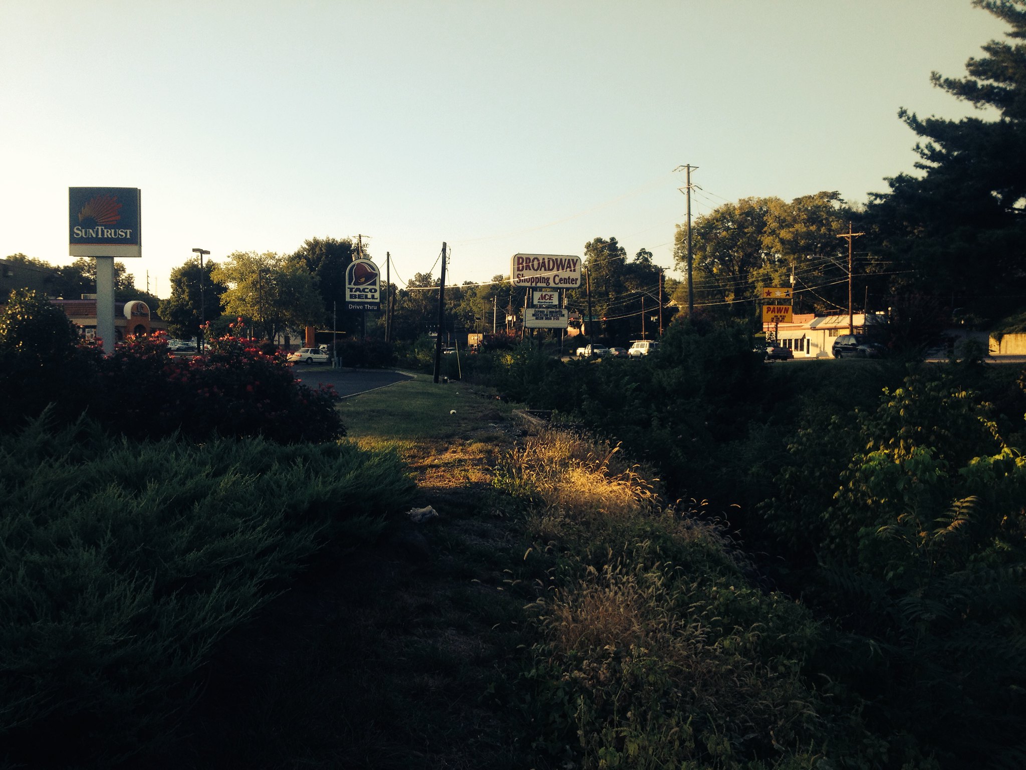
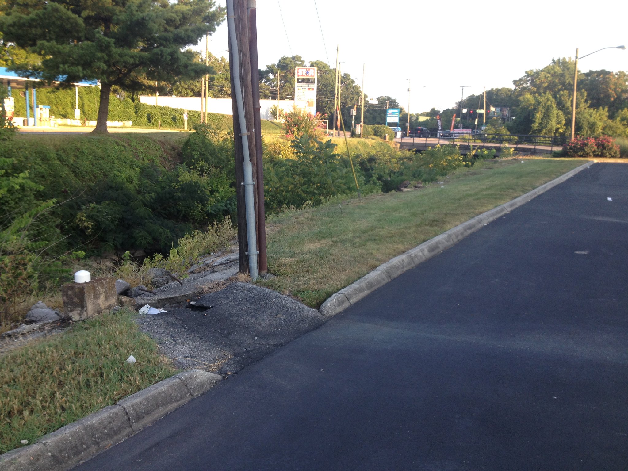
Scoping First Creek Greenway at Broadway Shopping Center
The City of Knoxville's plans for First Creek Greenway near First Creek Park route the path along dangerous, unenjoyable "Broadway" sidewalk.
Exaggerating, you say? There was an accident on Broadway literally as I was walking on the West side of First Creek. See the last video for the accident!
My alternative suggestion includes many benefits being entirely ignored by the city in their "feasibility" studies.
Benefits of the ideal alignment along First Creek include:
Economic
Health and Safety
Recreational
Broadway Shopping Center Landscaping
Private investment in aesthetics has already taken place.
Stormwater Infiltration Opportunity
Stormwater management at Broadway Shopping center is dated. Retention and filtration would positively impact water quality in First Creek.
Broadway Underpass / Broadway Tunnel - West Side
Like Cumberland Avenue underpass at Third Creek, and Neyland Drive Underpass at Second Creek, there is plenty of room for a passageway through the Broadway Viaduct.
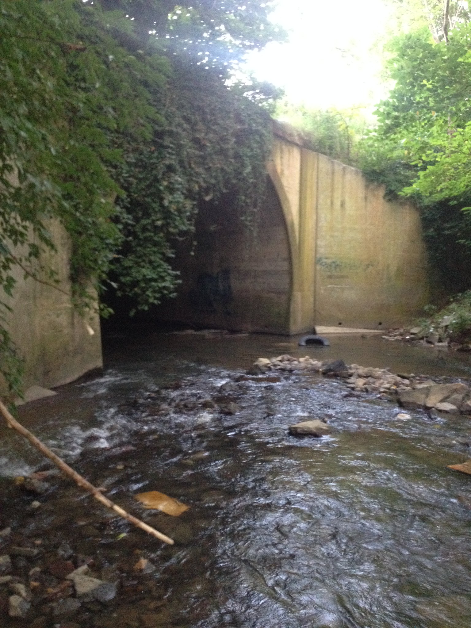
Broadway Tunnel from West Side Video
Video shows internal dimensions of the Broadway Viaduct.
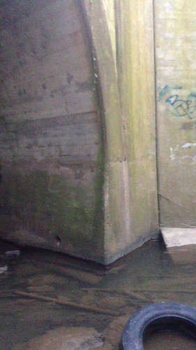
The Creekside Aesthetic
Broadway Tunnel from East Side Video
Broadway Viaduct from the East Side / First Creek Park.
A problematic crossing at Broadway
Design does not mitigate the problematic crossing.
I have no idea how you could consider people putting a greenway anywhere in that area.
Unless you never visited the site in person?
Kroger Fuel Center to Fulton High School
Could have a path through here. Not suer why it's not been done already. Complete with Raccoon! You're a little bit set back from the road here, don't have to worry about all of these people making turns blindly, and crossing right here, you're at the steps to Fulton high school! Right there.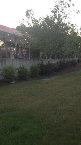
Steps of Fulton High School
From Woodland to Kroger Gas Station: the logical connection!
Idea of the Traffic Along Broadway.
Doesn't feel very safe just waiting here by the side of the street waiting to cross.
Death Awaits
There was actually an accident right on broadway while I was walking on the mortuary property! Check towards the last third of the video.
Exaggerating, you say? There was an accident on Broadway literally as I was walking on the West side of First Creek. See the last video for the accident!
My alternative suggestion includes many benefits being entirely ignored by the city in their "feasibility" studies.
Benefits of the ideal alignment along First Creek include:
Economic
- Improving access to / visibility to businesses at Broadway Shopping Center
- Reduced Creekside maintenance costs for property owners
- Adding to "park like" setting already invested in by private sector
- Removing "blighted" properties that encourage homeless camps (up for auction August 28, 2015)
- Reducing chemical pollution of First Creek by filtering de-icing agents, anti-freeze, oil, and other chemicals
- Reducing thermal pollution of First Creek by filtering hot parking lot runoff during storm events
- Reducing urban "heat island" effect by increasing "green" space and reducing wasted blacktop
- Reduced physical trash entry to First Creek from Broadway Shopping Center Parking lo
Health and Safety
- Reduced risk of death / accident from vehicles on Broadway
- Removing blind turns by setting street crossings back from Broadway / busy intersections
- Reduced exposure to carcinogenic motor vehicle exhaust / road dust from idling / passing vehicles
Recreational
- Reduced noise pollution by moving greenway users away from Broadway
- Increased urban forest canopy via plantings in otherwise blacktop surface
- Decreased time spent waiting for traffic signals / crossing opportunities
Broadway Shopping Center Landscaping
Private investment in aesthetics has already taken place.
Stormwater Infiltration Opportunity
Stormwater management at Broadway Shopping center is dated. Retention and filtration would positively impact water quality in First Creek.
Broadway Underpass / Broadway Tunnel - West Side
Like Cumberland Avenue underpass at Third Creek, and Neyland Drive Underpass at Second Creek, there is plenty of room for a passageway through the Broadway Viaduct.
Broadway Tunnel from West Side Video
Video shows internal dimensions of the Broadway Viaduct.
The Creekside Aesthetic
Broadway Tunnel from East Side Video
Broadway Viaduct from the East Side / First Creek Park.
A problematic crossing at Broadway
Design does not mitigate the problematic crossing.
I have no idea how you could consider people putting a greenway anywhere in that area.
Unless you never visited the site in person?
Kroger Fuel Center to Fulton High School
Could have a path through here. Not suer why it's not been done already. Complete with Raccoon! You're a little bit set back from the road here, don't have to worry about all of these people making turns blindly, and crossing right here, you're at the steps to Fulton high school! Right there.
Steps of Fulton High School
From Woodland to Kroger Gas Station: the logical connection!
Idea of the Traffic Along Broadway.
Doesn't feel very safe just waiting here by the side of the street waiting to cross.
Death Awaits
There was actually an accident right on broadway while I was walking on the mortuary property! Check towards the last third of the video.
Wednesday, August 12, 2015
City's First Creek "Creekside Example" Fails to Deliver
Brian and Chris,


First Creek Greenway is supposed to be the city's exemplar urban greenway project.
I didn't see anything "exemplary" in the plan we reviewed yesterday.
It demonstrated the same unimaginative, uninspired thinking that will not make the city a leader in urban recreational trails, and will not make Knoxville a "cool" city in which to live, work, and play.
Here's a map of an alternative I have in mind that seems more likely to meet greenway users' expectations for an actual "greenway," rather than a "sidewalk pretending to be a greenway."
My suggested path is nowhere near the City's and/or Ross/Fowler's concept.
And, as I expressed interest in at yesterday's Greenways Commission meeting, my path goes by the Howard House / Walmart property.
If the developer wants a Walmart at the parcel as depicted in the schematic shown above, the developer should be required to put in a greenway, as was done at Love's Creek Walmart in East Knoxville (see image below).

The Wal-mart developer's plans call for a "retaining wall" on the property, further "boxing in" First Creek and making it forever unaccessible to Knoxvillians to enjoy our natural heritage.
In the center of the conceptual image I created directly below is Centerpoint Church, where the Walmart and retaining wall on First Creek is planned.
Instead of losing this creek access to yet another concrete canyon, we should seize on it to install a greenway as part of the development.
Note the curving area along the Northwest side of First Creek at the top of the image: collaboration with two property owners is all that is needed to accomplish this.
Collaboration with one property owner is all that is needed to connect Atlantic to the Howard House property.
In all of these feasibility studies, the idea of collaboration with private property owners seems to be anathema, "too difficult to consider." I'd like to suggest that a thoughtful proposal for "what might be" could be the first step in convincing property owners to grant easements or other accommodations for greenway infrastructure.
Further up is in the image is the section, "Office Depot to Atlantic."
Although this shows a path along Broadway for a bit, gaining a truly "creekside" path seems to be the trade-off. And if a flood control project is done on the South side of Emoirland, perhaps even more "creekside" pathway could be installed.
Finally, the greenway should go on the West side of First Creek at Broadway Shopping Center.
I believe there is plenty of room, even with the gas station taken into account.
I also believe that the businesses at Broadway Shopping Center would welcome a greenway.
I also think we should try to go under the bridge, it is similar to the concrete arch bridge at Cumberland Avenue and Third Creek Greenway.
This brings me to a key complaint:
It infuriates me when sidewalks are proposed as greenways.
We should have greenways AND sidewalks, not sidewalks that are also greenways.
I don't want to be beside a road when I'm running, biking or walking.
Sidewalks are historically nicknamed "deathwalks."
It is only a matter of time before a car hops a curb and kills someone using a "greenway" on a sidewalk.
Besides risking death, I do not want to breath car exhaust or be splashed with oily road water during rain storms.
We do not need to be spending "greenway" funds on "neighborhood connectors" that should already have exemplary pedestrian infrastructure.
We do not need to be designing greenways along roadways.
I've put together some alternatives to the City's proposal, which I find unacceptable.
I do not understand the city's fixation with connecting Parks; this is the wrong way to go about things.
I don't understand the city's aversion to approaching private landowners as part of the feasibility study; this is also wrong.
The plans being proposed should present the "best" route, not the "easiest" route.
Furthermore, "best" for users is likely highly divergent from "best" for city planners.
We still don't have the criteria the city is using to advise Ross Fowler on the "best route."
"Connecting Parks" Should not be one of them.
As a spur? Certainly, I'm all for that.
But centering the design on Park connectivity, and "easiest" park connectivity at that, is incorrect.
For all of this money we're spending on "feasibility" concepts, we need to be inspiring people for what might be possible, not inspiring people to take the path of least resistance.
Sidewalk "greenways" and "neighborhood connectors" are not, by any stretch of the imagination, inspiring.
Thanks,
Tanner
Friday, July 31, 2015
Monday, July 27, 2015
RE: Request for Copy of TDOT Planning Document Pertaining to SmartFix40
Tanner,
The City of Knoxville is actually one of our greatest lease candidates. As part of Smartfix, we continue to lease the entire parking lot under what we called Bridge 16 to the City of Knoxville as well as several other locations. The City then leases several sections to locals including KARM.
You have been given correct information regarding control access facilities. When property is purchased as control access, we have to restrict access from that property as you have mentioned due to safety concerns. The piping you suggested also brings concerns regarding appropriate maintenance and access for maintenance required. Piping is always more difficult for clean-out than open ditches and is not recommended in the means in which you are presenting. A roadside ditch that runs parallel to interstate is already challenged in the appropriate access needed to successfully keep ditches and cross drains free from siltation and debris. To add another pipe in the same corridor would further complicate necessary clean-out procedures and add to maintenance costs in our annual drain cleaning contract along the Interstate.
Any permanent concepts on State Right of Ways regarding greenways would need to be presented by the City to be given to TDOT for review to determine feasibility. Please also note that TDOT cannot participate in the cost for greenway expansion as you are presenting. The municipality would be responsible for the extension and maintenance of the facility. The next step is really for you to discuss viable options with the City.
Thank you,
Kristin

Kristin Qualls, PE | District 18 Operations Engineer
Operations Division, District 18
7345 Region Lane
Knoxville, TN 37914
p. 865-594-2408
From: Tanner Jessel [mailto:mountainsol@gmail.com]
Sent: Monday, July 27, 2015 12:17 PM
To: Kristin Qualls; Chris Cherry; Brian Hann
Cc: Steve Borden; Mary Howard; mountainsol.greenway1@blogger.com
Subject: Re: Request for Copy of TDOT Planning Document Pertaining to SmartFix40
Hi Kristin,
Thanks for the info.
I'm forwarding this on to our Greenways Commission Chair and Vice Chair.
The landscaping was a great gift to Knoxville from TDOT, it's sad to hear the City didn't care for the gift properly.
The city's doing a bit better on maintenance as it hired an urban forester in 2012.
With some TLC from him, the site is better, but not quite what was originally "gifted," though.
I'm a bit concerned to hear about the state leases on TDOT property.
It seems to me like someone's conducting business on a parcel that they don't have to pay city or county taxes on.
Can you tell me if there is a current lease in place with the State for whatever business is operating there?
I don't mind to ask someone else if you don't know; Tim Webster comes to mind. I have his contact info as he also attends Greenways Commission meetings.
Concerning a greenway in the steep area along I-40 near the SmartFix40 site:
I don't think the City of Knoxville has much interest in the concept so you likely won't hear anything further on it.
It's been 7 years since SmartFix and the City still hasn't moved on a plan for a greenway path under the Interstate along First Creek between Glenwood and Sixth that everyone in Knoxville is asking for.
Basically I wanted to check with you about the possibility of putting:
1) a greenway on top of a rip rap drainage swale, using the method described, to preserve the State's investment in drainage infrastructure
2) a greenway between the access control fence and the sound barrier.
My problem is if when I go to the City with an idea, I'm often met with "TDOT would not let us do that so we won't even try" in general or "it's not possible to put a greenway path on top of a drainage system," as in this specific case, when it clearly is possible from the example I found.
So it's kind of a chicken and egg question on coming up with a plan: feasibility versus a plan.
Can you tell me how advanced of a study or plan would have to be presented for TDOT to provide input on the technical feasibility of a path between the access control fence and the sound barriers?
Also, can you tell me if a study or plan could done by anyone with appropriate credentials (Engineering, Landscape Architecture for example), or does any proposal have to come from the city for TDOT to provide input?
Thanks,
Tanner
On Mon, Jul 27, 2015 at 11:31 AM, Kristin Qualls <Kristin.Qualls@tn.gov> wrote:
Tanner,
Thank you for the information provided. I hopefully will be able to provide insight to several possibilities in regards to the questions presented.
1. The area along 6th avenue was the contractor's site for office space during construction of Smartfix40. After construction, the contractor continued with several City initiatives including the Transit Center and several bridge replacements/repairs projects in the area and was allowed to remain on State Right of Way. The State of Tennessee as well as the City of Knoxville have several leases with property owners and businesses such as seen here.
2. The landscaping plan and work performed during Smartfix was discussed prior to construction that the maintenance to the site would be handled by the City of Knoxville. Since maintenance on the landscaping has not been performed as originally arranged, further maintenance by state forces has been greatly hindered. TDOT county maintenance forces have begun in several locations to remove thick vegetative areas in similarly landscaped areas such as Papermill and Weigarber in order to improve access for maintenance purposes. The same approach will also be taken along the Interstate corridor of Smartfix in the near future so that areas mentioned in your email can be easily accessed for debris removal.
3. Areas along State Right of Way that are outside the control access fence are the responsibility of the City of Knoxville to maintain. Areas along 6th Avenue and Hall of Fame would still revert to the City for maintenance needs between the curb line and control access fence as also detailed in Tennessee Code Annotated.
4. The area in which you are recommending greenway facilities is quite steep. TDOT does often permit the City of Knoxville access to build greenways; however, the City is responsible for designing a plan and submitting for approval. If this idea is an option that the City of Knoxville desires to pursue, I would encourage further dialogue be made between you and the City of the Knoxville for further planning initiatives.
Again, thank you for your recommendations. Thinking outside the box and providing recommendations for improvements is always commended. I wish you well in your endeavors for furthering greenway access in the Knoxville area. If you have further questions or comments, please do not hesitate to contact me at your convenience.
Thank you,
Kristin
Kristin Qualls, PE | District 18 Operations Engineer
Operations Division, District 18
7345 Region Lane
Knoxville, TN 37914
p. 865-594-2408
From: Tanner Jessel [mailto:mountainsol@gmail.com]
Sent: Thursday, July 16, 2015 1:00 PM
To: Kristin Qualls
Subject: Fwd: Request for Copy of TDOT Planning Document Pertaining to SmartFix40
Hi Kristin,
I live in Knoxville near the SmartFix40 project site.
I also serve on Knoxville's Greenways Commission, appointed by Mayor Rogero.
I'm writing today doing some independent research on two items.
First, the landscape plans I requested from TDOT indicates a parcel of land (that I presume belongs to TDOT) was planned to be landscaped.
The rendering is here; the parcel in question is bordered by I-40 West, 6th Avenue, and First Creek:

Looks great, right?
In contrast, here's what we have today at this location, from Google Maps aerial imagery acquired in September 2014, more than 5 years after the SmartFix40 project ended:

Note the parcel is not landscaped, and seems to be in use by a construction business.
I'm unable to locate any property tax records for whatever business is operating at this location, and no parcel information is available in public facing GIS system, www.kgis.org
Do you have any idea what's happened here?
Do you have any idea why landscaping was never carried out on this parcel?
My second inquiry concerns the drainage swale outside the retaining walls on I-40.
I am personally interested in the idea of routing a greenway along that corridor, so I took it upon myself in March to venture behind the fencing and investigate.
What I found might be of concern to you:
The drainage system set up by TDOT is filling up with invasive plants and trash.
From this photo, I imagine it won't be long before the drainage system fails:

I can only imagine the headaches that a failed drainage system will cause TDOT over time.
I'm obviously biased, but I'm thinking that a Greenway path alongside the drainage swale would provide easier access to the area in question to do maintenance activities and keep the invasives & debris in check.
I'm not an engineer or landscape architect and perhaps overly optimistic about possibilities, but I also found this example where a trail was installed on top of a drainage ditch:
At any rate, I imagine you'd want to know about the trash & plants taxing your drainage system.
In revisiting this, I'm hopeful that some kind of solution might involve a greenway path to allow area residents to enjoy the view from Chestnut Ridge, much in the way that trail users can enjoy the view from Papermill Bluffs, which I understand was installed as part of the SmartFix 40 project.
I have a picture and PDF of what that might look like, connecting N. Sixth Avenue to Cherry Street via TDOT ROW and Chestnut Ridge, see below and the link to reference the original document.


The PDF I marked up is too large at 4.5 MB to send via e-mail attachment, but you can see the original document at <https://web.archive.org/web/20081231021742/http://www.tdot.state.tn.us/smartfix/jwp/map/SmartFIX40.pdf>.
Thanks for any information,
Tanner
---------- Forwarded message ----------
From: Steve Borden
Date: Mon, Jul 13, 2015 at 2:15 PM
Subject: Re: Request for Copy of TDOT Planning Document Pertaining to SmartFix40
To:
Cc: TDOT Comments
Thank you for your inquiry regarding Landscaping Plans on SmartFIX40. The landscape design that was included in the project plans are attached for your convenience.
Should you have further questions or concerns upon review, please contact the District 18 Operations Engineer, Ms. Kristin Qualls, at (865) 594-2408 or Kristin.Qualls [at] tn.gov.
Steven M. Borden, P.E.
Director/Assistant Chief Engineer
TDOT – Region 1
jmh
How are we doing? Customer Service Survey
From: Tanner Jessel
Sent: Friday, July 10, 2015 12:16 PM
To: TDOT Comments
Subject: Request for Copy of TDOT Planning Document Pertaining to SmartFix40
*** This is an EXTERNAL email. Please exercise caution. DO NOT open attachments or click links from unknown senders or unexpected email. - OIR-Security***
There is a document online that appears to be a deliverable for the TDOT SmartFix40 project.
It's called "I-40/Hall of Fame Drive Project Two Landscape Plan, dated January 2008.
It looks like it has Wilbur Smith Associates logo and another small, indistinguisable logo, perhaps from Penland Studio, where I found the reduced filesize version of the plan:
I have reviewed the SmartFix40 site as archived at https://web.archive.org/web/20081230232210/http://www.tdot.state.tn.us/smartfix/jwp/
I was unable to locate any documents pertaining to "Landscape Plan" on the archived site.
I am hoping that TDOT has retained copies of the Landscape Plan and is able to forward them to me.
Thanks,
Tanner
Re: Request for Copy of TDOT Planning Document Pertaining to SmartFix40
Hi Kristin,
Thanks for the info.
I'm forwarding this on to our Greenways Commission Chair and Vice Chair.
The landscaping was a great gift to Knoxville from TDOT, it's sad to hear the City didn't care for the gift properly.
The city's doing a bit better on maintenance as it hired an urban forester in 2012.
With some TLC from him, the site is better, but not quite what was originally "gifted," though.
I'm a bit concerned to hear about the state leases on TDOT property.
It seems to me like someone's conducting business on a parcel that they don't have to pay city or county taxes on.
Can you tell me if there is a current lease in place with the State for whatever business is operating there?
I don't mind to ask someone else if you don't know; Tim Webster comes to mind. I have his contact info as he also attends Greenways Commission meetings.
Concerning a greenway in the steep area along I-40 near the SmartFix40 site:
I don't think the City of Knoxville has much interest in the concept so you likely won't hear anything further on it.
It's been 7 years since SmartFix and the City still hasn't moved on a plan for a greenway path under the Interstate along First Creek between Glenwood and Sixth that everyone in Knoxville is asking for.
Basically I wanted to check with you about the possibility of putting:
1) a greenway on top of a rip rap drainage swale, using the method described, to preserve the State's investment in drainage infrastructure
2) a greenway between the access control fence and the sound barrier.
My problem is if when I go to the City with an idea, I'm often met with "TDOT would not let us do that so we won't even try" in general or "it's not possible to put a greenway path on top of a drainage system," as in this specific case, when it clearly is possible from the example I found.
So it's kind of a chicken and egg question on coming up with a plan: feasibility versus a plan.
Can you tell me how advanced of a study or plan would have to be presented for TDOT to provide input on the technical feasibility of a path between the access control fence and the sound barriers?
Also, can you tell me if a study or plan could done by anyone with appropriate credentials (Engineering, Landscape Architecture for example), or does any proposal have to come from the city for TDOT to provide input?
Thanks,
Tanner
On Mon, Jul 27, 2015 at 11:31 AM, Kristin Qualls <Kristin.Qualls@tn.gov> wrote:
Tanner,
Thank you for the information provided. I hopefully will be able to provide insight to several possibilities in regards to the questions presented.
1. The area along 6th avenue was the contractor's site for office space during construction of Smartfix40. After construction, the contractor continued with several City initiatives including the Transit Center and several bridge replacements/repairs projects in the area and was allowed to remain on State Right of Way. The State of Tennessee as well as the City of Knoxville have several leases with property owners and businesses such as seen here.
2. The landscaping plan and work performed during Smartfix was discussed prior to construction that the maintenance to the site would be handled by the City of Knoxville. Since maintenance on the landscaping has not been performed as originally arranged, further maintenance by state forces has been greatly hindered. TDOT county maintenance forces have begun in several locations to remove thick vegetative areas in similarly landscaped areas such as Papermill and Weigarber in order to improve access for maintenance purposes. The same approach will also be taken along the Interstate corridor of Smartfix in the near future so that areas mentioned in your email can be easily accessed for debris removal.
3. Areas along State Right of Way that are outside the control access fence are the responsibility of the City of Knoxville to maintain. Areas along 6th Avenue and Hall of Fame would still revert to the City for maintenance needs between the curb line and control access fence as also detailed in Tennessee Code Annotated.
4. The area in which you are recommending greenway facilities is quite steep. TDOT does often permit the City of Knoxville access to build greenways; however, the City is responsible for designing a plan and submitting for approval. If this idea is an option that the City of Knoxville desires to pursue, I would encourage further dialogue be made between you and the City of the Knoxville for further planning initiatives.
Again, thank you for your recommendations. Thinking outside the box and providing recommendations for improvements is always commended. I wish you well in your endeavors for furthering greenway access in the Knoxville area. If you have further questions or comments, please do not hesitate to contact me at your convenience.
Thank you,
Kristin
Kristin Qualls, PE | District 18 Operations Engineer
Operations Division, District 18
7345 Region Lane
Knoxville, TN 37914
p. 865-594-2408
From: Tanner Jessel [mailto:mountainsol@gmail.com]
Sent: Thursday, July 16, 2015 1:00 PM
To: Kristin Qualls
Subject: Fwd: Request for Copy of TDOT Planning Document Pertaining to SmartFix40
Hi Kristin,
I live in Knoxville near the SmartFix40 project site.
I also serve on Knoxville's Greenways Commission, appointed by Mayor Rogero.
I'm writing today doing some independent research on two items.
First, the landscape plans I requested from TDOT indicates a parcel of land (that I presume belongs to TDOT) was planned to be landscaped.
The rendering is here; the parcel in question is bordered by I-40 West, 6th Avenue, and First Creek:
Looks great, right?
In contrast, here's what we have today at this location, from Google Maps aerial imagery acquired in September 2014, more than 5 years after the SmartFix40 project ended:
Note the parcel is not landscaped, and seems to be in use by a construction business.
I'm unable to locate any property tax records for whatever business is operating at this location, and no parcel information is available in public facing GIS system, www.kgis.org
Do you have any idea what's happened here?
Do you have any idea why landscaping was never carried out on this parcel?
My second inquiry concerns the drainage swale outside the retaining walls on I-40.
I am personally interested in the idea of routing a greenway along that corridor, so I took it upon myself in March to venture behind the fencing and investigate.
What I found might be of concern to you:
The drainage system set up by TDOT is filling up with invasive plants and trash.
From this photo, I imagine it won't be long before the drainage system fails:
I can only imagine the headaches that a failed drainage system will cause TDOT over time.
I'm obviously biased, but I'm thinking that a Greenway path alongside the drainage swale would provide easier access to the area in question to do maintenance activities and keep the invasives & debris in check.
I'm not an engineer or landscape architect and perhaps overly optimistic about possibilities, but I also found this example where a trail was installed on top of a drainage ditch:
At any rate, I imagine you'd want to know about the trash & plants taxing your drainage system.
In revisiting this, I'm hopeful that some kind of solution might involve a greenway path to allow area residents to enjoy the view from Chestnut Ridge, much in the way that trail users can enjoy the view from Papermill Bluffs, which I understand was installed as part of the SmartFix 40 project.
I have a picture and PDF of what that might look like, connecting N. Sixth Avenue to Cherry Street via TDOT ROW and Chestnut Ridge, see below and the link to reference the original document.
The PDF I marked up is too large at 4.5 MB to send via e-mail attachment, but you can see the original document at <https://web.archive.org/web/20081231021742/http://www.tdot.state.tn.us/smartfix/jwp/map/SmartFIX40.pdf>.
Thanks for any information,
Tanner
---------- Forwarded message ----------
From: Steve Borden
Date: Mon, Jul 13, 2015 at 2:15 PM
Subject: Re: Request for Copy of TDOT Planning Document Pertaining to SmartFix40
To:
Cc: TDOT Comments
Thank you for your inquiry regarding Landscaping Plans on SmartFIX40. The landscape design that was included in the project plans are attached for your convenience.
Should you have further questions or concerns upon review, please contact the District 18 Operations Engineer, Ms. Kristin Qualls, at (865) 594-2408 or Kristin.Qualls [at] tn.gov.
Steven M. Borden, P.E.
Director/Assistant Chief Engineer
TDOT – Region 1
jmh
How are we doing? Customer Service Survey
From: Tanner Jessel
Sent: Friday, July 10, 2015 12:16 PM
To: TDOT Comments
Subject: Request for Copy of TDOT Planning Document Pertaining to SmartFix40
*** This is an EXTERNAL email. Please exercise caution. DO NOT open attachments or click links from unknown senders or unexpected email. - OIR-Security***There is a document online that appears to be a deliverable for the TDOT SmartFix40 project.
It's called "I-40/Hall of Fame Drive Project Two Landscape Plan, dated January 2008.
It looks like it has Wilbur Smith Associates logo and another small, indistinguisable logo, perhaps from Penland Studio, where I found the reduced filesize version of the plan:
I have reviewed the SmartFix40 site as archived at https://web.archive.org/web/20081230232210/http://www.tdot.state.tn.us/smartfix/jwp/
I was unable to locate any documents pertaining to "Landscape Plan" on the archived site.
I am hoping that TDOT has retained copies of the Landscape Plan and is able to forward them to me.
Thanks,
Tanner


Subscribe to:
Posts (Atom)