Tuesday, May 26, 2015

Viewing nature can help your brain work better, study finds - The Washington Post


The Vancouver Convention Center’s six-acre living roof in Vancouver, Canada, on Thursday, Oct. 9, 2014. According to the convention center it’s the largest green roof in Canada. (AP Photo/The Canadian Press, Darryl Dyck)


Viewing nature can help your brain work better, study finds - The Washington Post:


The research adds to a growing scientific literature on the health advantages — psychological and otherwise — of being exposed to views of nature in urban settings, for instance through the presence of parks or trees. Research in this area is so far along, in fact, that researchers are considering whether it might be possible to identify the right “dose” of nature that people need to receive in order to actually reap significant health benefits.

Friday, May 15, 2015

"Report" Feature for Slope of Path via Texas A&M Forest Service

Good eye!

Thank you!

I serve on our local greenways commission for planning greenway routes.

My desired routes are often at odds with what landscape architects come up with, especially when it comes to slope.

The fact is, I'm both lazy and a fan of efficiency and don't want to ride my bike on a steep slope, so I want to easily contrast the slope of my preferred route with the architect's route.

Generating snazzy reports like this very quickly and with minimal effort and minimal access to spatial datasets is very useful.

I like how it pulled in the topo as the base layer, also.


Thanks,

Tanner


On Fri, May 15, 2015 at 10:15 AM, Vara, Fernando <fvara@tfs.tamu.edu> wrote:

Hello Tanner,


First of all thank you for taking the time for testing our application.


You are right, the "report" button on the elevation profile is generating a PDF. Once the PDF is generated it pop-ups in a new tab of your browser.

As I can see in your screenshot you have the pop-up windows disabled in your chrome browser (see in the right of the browser's navigation bar you have a window with an red "x" ).


I think you just need to enable those pop-ups for the web site in order to see the PDF.


Try that and let me know if it works.


Thanks,


Fernando Vara
Geospatial Developer | Texas A&M Forest Service
200 Technology Way, Suite 1281 | College Station, TX 77845

Office: (979) 458-6630 | Fax: (979) 458-6650

fvara@tfs.tamu.edu


From: Tanner Jessel [mailto:mountainsol@gmail.com]
Sent: Friday, May 15, 2015 9:06 AM
To: Vara, Fernando
Subject: "Report" feature on Mac


Hi there, 


I just read this with interest:


I tried it out but I'm wondering about a feature I'm interested in:


The "report" button on the elevation profile.


Is it supposed to generate some kind of PDF or other document when you click it?

When I click it, nothing happens. 


I'm using a mac with Google Chrome.


Thanks for any help.


-Tanner


Thursday, May 14, 2015

How Bicycles Bring Business | Momentum Mag

How Bicycles Bring Business | Momentum Mag:


Even city officials and transportation planners are recognizing that the small cost of bike infrastructure provides a big payoff for taxpayers and business owners. While the price tag on a bike lane is a fraction of the cost of a single mile of freeway, researchers at the Political Economy Research Institute found that building bicycle and pedestrian infrastructure creates nearly 50 percent more jobs than road-only projects. And that’s just the beginning of the equation.

Monday, May 11, 2015

The solar road in the Netherlands is working even better than expected - ScienceAlert

The solar road in the Netherlands is working even better than expected - ScienceAlert:


StarryNight


 The potential is pretty huge. Not only could the roads generate enough electricity to power local households, but they can also provide some amazing lighting opportunities. Last year a solar road was installed in the Netherlands by design lab Studio Roosegaarde, which sucked up the Sun's energy during the day and then guided cyclists at night using beautiful Vincent Van Gogh 'Starry Starry Night- inspired LED lights.


Thursday, May 7, 2015

The Future of America's Cities Lies in the Past

The Future of America's Cities Lies in the Past | Kate Ascher:


Other forms of civic infrastructure are changing, too, as they adapt to the new patterns of settlement. Investment in urban parks is on the rise, albeit much of it coming from private sources. These range from pocket parks, adopted by local groups or corporations, to central gathering places, like Millenium Park in Chicago or Central Park in New York, to new linear parks along once-active waterfronts or rail lines. More and more of these once-forgotten spaces will become cherished resources for workers, tourists and residents.

Burris St. Connection Should be Reserved for First Creek Greenway

Lori and Jon:

I have noticed that the parcel represented in KGIS as immediately adjacent to First Creek is not legally defined as having a boundary immediately adjacent to First Creek as suggested by the KGIS data model for that parcel


Therefore, the area adjacent to the creek on former "Burris Street" should be free to route the First Creek Greenway along it, rather than taking Willow Avenue streetside to Central.

Note the description of "Tract XV" in the attachment, "20010416006956.tif" indicates"

The property line is defined as Burris Street from Willow to Vine Avenue, which was presumably closed when Vine Avenue became Summit Hill Drive.

Today, the parking lot operator has appropriated the closed Burris street to add additional parking spaces as shown in aerial imagery acquired in 2014 and available in KGIS.

Perhaps there are "squatters rights" involved here, but so far as I can tell the formal legal description of the parcel on record with the County does not grant those rights at this time.

Therefore, I believe that the closed "Burris Street" should be reserved as part of the planned greenway connection from Willow Avenue to Central Street along First Creek.

Thanks,

Tanner

Wednesday, May 6, 2015

Rogero budget boosts facilities, green space, would cover courthouse purchase

Rogero budget boosts facilities, green space, would cover courthouse purchase:


Spending that Rogero highlighted during Wednesday's hour-long presentation focused on increased funding for parks and greenways, youth development, blight abatement, city center redevelopment and historic preservation.

New Resource to Stop Invasive Species in their Tracks

Mud and seeds on shoes


USDA Blog: A New Way to Stop Invasive Pests – Clean Recreation:


PlayCleanGo is designed to give outdoor recreationists a clear call to action to be informed and attentive in helping stop the spread of invasive plants and insects and improving overall forest health,” said Monica Lear, U.S. Forest Service Forest Health Protection Director. “These pests can expand like a different kind of wildfire, from forest to forest by unsuspecting visitors just looking for some fun and adventure.

Upper and Lower First Creek Greenway Channel Trail Connection

Brian, 

I'm with you on temporary signage and a possible Greenway spur on Mitchell St. near Abbey Fields, but I remain unconvinced that a trail in the channel for First Creek isn't viable.

I am not ready to give up on a connection between Upper and Lower First Creek via the creekside and channel route,

Principally because not only do we see this approach taken at Third Creek Greenway under Cumberland Avenue and Second Creek at Neyland Drive, there are more examples from "Low water stream crossings for trails and greenways" at American Trails.


Of particular interest:

"Waller Creek Trail is built on concrete pad in flood channel, Austin, Texas; photo by Stuart Macdonald, July 15, 2007."


The trail crosses the creek via concrete low water crossing bridges 8 times in this section, according to http://www.austinparks.org/our-parks.html?parkid=367  


While the trail was originally built in 1976, perhaps still in the "wild west" of creekside greenway construction, it's recently been renovated: https://www.wallercreek.org/about/timeline/.  

From what I can tell, most of this trail is within the FEMA floodplain. Note that Austin does struggle with flooding events damaging the trail.

Here's FEMA's National Flood Hazard Layer, set to Austin Texas at the Waller Creek Trail terminus on the Colorado River:


http://arcg.is/1EWmucu


By comparison, here's Knoxville Tennesse at First Creek - in fact, there appears to be far less "floodable" area than Waller Creek. 


http://arcg.is/1EWmLfv


For further comparison, Here's Knoxville Tennessee at Third Creek and Cumberland:


http://arcg.is/1EWmSrq


And of course our lovely Third Creek Greenway underpass at Cumberland built just a few years ago.
The Austin Waller Creek Greenway trail is part of Waller Creek Conservancy, a source of pride and re-development in Austin, TX: https://www.wallercreek.org/map/.

I see a lot of similarities between Waller Creek in Austin and First Creek in Knoxville.

I think it'd be worthwhile for our board to see what lessons we can learn from Austin's Waller Creek Conservancy that can be applied to First Creek - particularly with respect to the low-water bridges and flood channel pathways.

Re: Greenway Corridor Descriptions

Hi Chris,

I am not a fan of "short cuts" because I think this is our one shot:

Brian has mentioned that whatever we get will be our greenways for the next 20 years or so.

That's especially true because if we get a grant to fund a "bad" connection now, we cant get money to repeat the route on the "better" route.

One compromise / temporary solution that's acceptable to me is bypassing the "problem area" on TDOT land and Standard Knitting Mill.


I'm not ready to give up the "better" route entirely, but I accept the proposal Brian and Jon have made for a short-term fix.

We need something; it's embarrassing for the City and commission we haven't had movement on this.

I think it's crazy the city has sat on finishing the connection along the creek on TDOT land since the SmartFix40 project "daylighted" First Creek back in 2007.

I'm going to disagree with you on the idea that the route along the creek makes less sense as part of a connected network or potentially costs more.

If we don't build the route along the creek now, using grant money for "safe routes to schools" etc, then we're not ever going to get a route along the creek.

Plus, a creekside route truly is safer - if we force the issue on getting KUB to give us their land as originally proposed for a creekside "KUB Park" that goes UNDER magnolia avenue near KAT garage, (where a bridge already exists), then you eliminate a 4 lane federal highway crossing AND you get the recreational, aesthetic, and health benefits of a more park-like route.


I also disagree that it will cost more - most of the desired route is along an old railroad grade - so a graded path already exists for most of the route.

This is why I cannot understand what's going on with the City and Willow Avenue. 

If a path already exists following a historic railroad grade, why is the consultant studying Willow and Jessamine? 

If the City is passionate about adding bike lanes, landscaped sidewalks, and striping, great.  

Just don't call it a greenway; call it what it is: a streetscape project.

A true Greenway proposal is one that creates a riparian buffer and walking path with views of First Creek.


I've created an overall map of my "preferred route" in Google Earth and uploaded it to my Google Maps:


The route is 1.88 miles long.

When you combine it with the "William Blount" greenway I've also proposed, you end up with an integrated corridor connecting North Knoxville to the Tennessee River and UT Campus.

(You're right, by the way, the "William Blount" greenway should connect to Second Creek along Neyland, I'm just feeding one small connection at a time).

-Tanner

Tuesday, May 5, 2015

Knoxville police increase presence after greenway murder | WATE-TV


Knoxville police increase presence after greenway murder | WATE-TV:


Chief Rausch says both he and Mayor Madeline Rogero feel the need to increase police presence in Knoxville’s parks and greenways, especially at the Third Creek Greenway.

That’s in addition to continuing the neighborhood bike officers program, which is a unit assigned specifically to parks and greenways.


“They are constantly out in the areas. They’re riding bikes on the greenways. They’re checking people out. They’re doing special assignments to maintain safety in those areas,” said Chief Rausch.


Video: http://wate.com/2015/05/04/knoxville-police-increase-presence-after-greenway-murder/

Knox-Blount Greenway inching along - News Sentinel Story

Knox-Blount Greenway inching along - News Sentinel Story:


The Knox County Commission approved a resolution March 23 giving county parks officials the go-ahead to work with Knoxville and Tennessee Department of Transportation officials to build part of the Knox-Blount Greenway.

Monday, May 4, 2015

KPD: Greenways Safe Despite Fatal Stabbing

KPD: Greenways Safe Despite Fatal Stabbing:


Chief Rausch says Ison did spend 5 years in a Kentucky prison for a violent crime.


Rausch says Ison won’t be able to hurt anyone else anytime soon and he does believe this was an isolated incident and our greenways are safe.


 Rausch says, “I’ve been here almost 23 years and this is the first incident of this type in my recollection. This is the first homicide that I know of on our greenway.”

Still, Rausch says they will increase their police presence on the greenways to help people feel more comfortable.


He also offers safety tips like exercising with a buddy or being aware of your surroundings.

Man charged in fatal stabbing of woman, 41, on Third Creek Greenway

Man charged in fatal stabbing of woman, 41, on Third Creek Greenway - News Sentinel Story:


KNOXVILLE — Police have charged a man with murder in connection with the stabbing Sunday of a 41-year-old woman on the Third Creek Greenway in West Knoxville.   [ . . . ]
Based on a description of the attacker provided by witnesses, police arrested Timothy Dwayne Ison, 24, of Knoxville within 30 minutes of the assault 'as he was attempting to leave the parking lot to the greenway,' police said Monday. 


Chehaw: "Nature's Playground" in Albany, Georgia

Model for Knoxville?  700 acres is a lot.


Welcome to Chehaw | Chehaw, Nature's Playground | Albany, Georgia:


With over 700 acres of pristine, conservation land and a wild animal park dedicated to education, Chehaw is a unique attraction for South Georgia. Being one of the only two accredited zoos in Georgia, aside from Zoo Atlanta, Chehaw continues to be devoted to the three areas it was founded on: conservation, preservation and education.
For comparison, the Urban Wilderness is reportedly 1,000 acres.


Knoxville Urban Wilderness, a recreational, cultural, and historic preservation initiative championed by Legacy Parks Foundation, incorporates 1,000-forested acres along downtown’s south waterfront. It creates an exceptional recreation and historic corridor inviting residents and visitors to experience the special character-defining assets of our city. With over 40 miles of multi-use trails, 10 parks, four civil war sites, incredible views, and unparalleled natural features, this unique area provides a premiere outdoor experience.

City Greenways Data

Good morning,

I have a commission from Mayor Rogero to serve on the city Greenways Board from 2015 - 2018.

I'm doing a spatial analysis and am creating my own spatial data delineating city greenways and parks by referencing 1 ft orthoimagery from USGS National Map Viewer, Google Earth, and KGIS online map viewer.

I am aware that KGIS data is more robust - particularly when I have to "guesstimate" a greenway's path when obscured by forest cover.

Do you happen to know if Knoxville Parks and Rec has access to the same spatial data for greenways as is presented in your "topography" layer?

I suppose what I mean to ask is, is there a fee-for-service for city departments as described at <http://www.kgis.org/portal/Products/DigitalData/PurchaseInformation.aspx>?

Thanks,

Tanner

Toward Improved Public Health Outcomes From Urban Nature

Toward Improved Public Health Outcomes From Urban Nature:


There is mounting concern for the health of urban populations as cities expand at an unprecedented rate. Urban green spaces provide settings for a remarkable range of physical and mental health benefits, and pioneering health policy is recognizing nature as a cost-effective tool for planning healthy cities.


Related article:


http://www.washingtonpost.com/news/to-your-health/wp/2015/04/08/doctors-orders-take-two-nature-doses-and-call-me-in-the-morning/


Sunday, May 3, 2015

Is it time to re-think greenway safety in Knoxville following homicide?

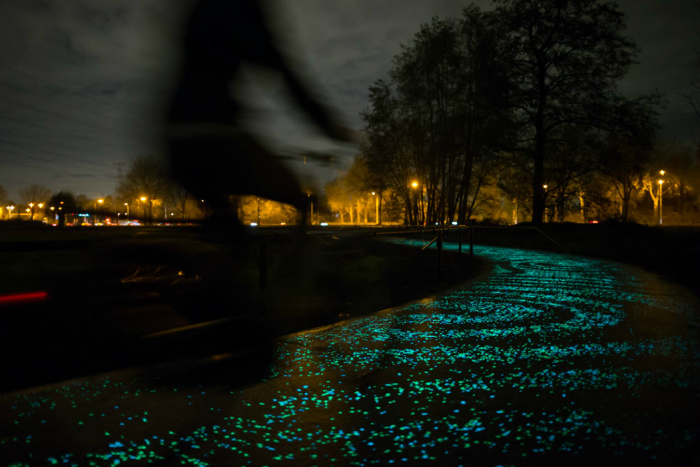
Terrible news from the Third Creek Greenway: a woman has been fatally stabbed, suffering from multiple stab wounds.

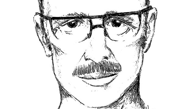
It happened around 7:30 PM near West High School. A suspect was reported to be at large, with witnesses who were able to describe the assailant.  A "person of interest" was detained for interviews, but no additional details were made available.

Commenters on local news sites have pointed out that this looks like the "spur" of Third Creek Greenway connecting sutherland Avenue to the Third Creek Greenway.

Later reporting from Knoxville News Sentinel confirmed this:
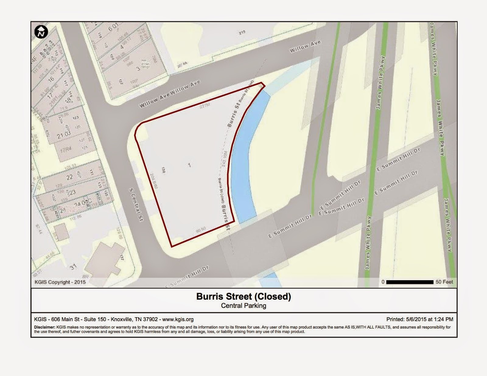
The attack was reported at 7:24 p.m., about an hour before dark. Responding officers discovered the deceased victim with multiple stab wounds about 150 yards down the greenway from a trailhead parking lot on the 3100 block of Sutherland Avenue, Knoxville Police Department spokesman Darrell DeBusk said.
I've followed the comments on the stories and notice a lot of people are talking about the need for a concealed carry right in public parks.  Politics of that debate aside, I'm not sure that's realistic, simply because guns are expensive and as former Knoxville Mayor Bill Haslam has pointed out, greenways and parks are often adjacent to or cross gun-free school zones.

UPDATE: Police have a person of interest in custody in connection to the stabbing this evening on Third Creek Greenway. We now know a woman died from multiple stab wounds. DETAILS: http://on.wbir.com/1FJoq70

Posted by WBIR Channel 10 on Sunday, May 3, 2015
BREAKING: We are at the scene of what KPD says is a stabbing at a greenway in Knoxville http://6.wate.com/1bTAHK1

Posted by WATE 6 On Your Side on Sunday, May 3, 2015
Police are now investigating a stabbing on the Third Creek Greenway as a homicide. DETAILS -->http://www.local8now.com/home/headlines/Police-investigating-homicide-on-Knoxville-Greenway-302367101.html

Posted by WVLT Local 8 on Sunday, May 3, 2015

Unfortunately not many people seem to be aware that we have a dedicated parks and greenway patrol unit in the City of Knoxville.

In fact, KPD always has a representative at our greenways commission meetings to provide input from the law enforcement community's perspective.

As of 2013 when the unit was officially launched, the unit had 9 officers patrolling 7 days a week.

That's excellent.

However, I think it's time that we add more officers.

Part of the point of the parks and greenway patrol unit is to deter crime.

Sgt. Sammy Shaffer has stated that just the sight of an officer on a bike can deter illegal activity.

But logistically speaking, the deterrent would be more effective with more officers.


I'm unsure of the costs of adding on more patrols and more officers - it seems like greenway patrol would be a popular detail, though.

Another option might be to have more "greenway rangers" acting as eyes and ears for existing officers, who might not have the same training as an officer in terms of law enforcement, but who could assist with ensuring safety.  Regular, dense patrols would be an excellent deterrent to crime on greenway trails.

This latest incident is particularly troubling to me because it is the fourth local incident of a woman being the victim of crime on a greenway.  One incident near Ijams on the Will Skelton Greenway happened in August 2013; another soon after in September, 2013 - the student assaulted said she saw the man again a half our later.  Then within the same 3 week timeframe, another incident - this time a man with a knife threatening a woman - on a West Knoxville Greenway. Outside the Knoxville area, a woman was assaulted on a walking path between Sugarlands Visitor Center and Gatlinburg in June 2009, and in Maryville's Greenbelt in 2003 and 2008.  These are just the ones in recent memory and that have been reported - is it any wonder that women might not feel safe on greenways?

We need to make sure all our residents are safe on greenways, but especially women.  Enjoying the city's greenway trails must not become a terrifying prospect to women. Fear and safety concerns risk cutting off half of the city's residents from greenways.

Every solution incurs a cost - from mere dollars to broader issues like erosion of civil liberties from increased surveillance.

However there are certainly ideas out there worth pursuing.

For example: an emergency alert system for runners and joggers.

A simple approach would be to use Twitter to deliver timely alerts to mobile phones via text message:

I toyed around with this idea for a time for my neighborhood.

Basically, when something happens, a Tweet goes out to my neighborhood alert twitter account.

Those who subscribe via simple message service (SMS), aka "text message," would get a weekly alert for crime updates - OR - in the case of an emergency - a special message.

This can be useful for a couple of reasons:

First - ensuring safety.  If you're about to start your evening run, you don't want to head out on the trail if there's a criminal on the loose.

Second - it can assist with apprehending a suspect - picture or text description.

Third - alerting nearby trail users to a person in need - a fellow hiker or runner might be closer than a first responder.

It's unfortunate that we don't have an alert system in place from city government - which could be useful for trail emergencies of all types, including natural hazards.

A second major solution might be to install emergency "blue light" call boxes at regular, predictable intervals.  In an emergency or panic situation - a cell phone might not be the most reliable option.  But, knowing an emergency call box was within reach - which are often equipped with large buttons that can easily be pressed in a panic - could go a long way to adding piece of mind and functional help to those in need.


Along these lines, we could look at cameras.  While there are concerns about surveillance, the incident at Ijams and the Great Smoky Mountains both required a police sketch. A camera might help not only with deterrence but with apprehending assailants.  Witnesses were key to preventing a second assault from happening at Ijams - but witness descriptions require someone to be around.  Cameras are always around!


Finally, we need more officers in the city's Greenway Patrol Unit.  Officers are the single best deterrent to crime - and they are also first responders to injuries.  We only have 9 officers in the unit right now, and although they patrol 7 days a week and even after dark, with 4,000 patrols made in the first year (2013 - 2014)


But the fact is, our trail mileage and Park acreage is greater than what our officers can reasonably be expected to patrol at the level of intensity that might be optimal to deter and prevent crime. Officers on the trails increases our police visibility, which hopefully will deter crime and help increase perceptions of safety.  It also directly impacts safety:  officers on the trails get to know the trails and can respond to problems and accidents just like on our roads.


Now, a request that has come from KPD is that our trails have better markers.  The city needs to undertake to assist our officers in responding to emergencies and problems is a system of mile markers, similar to what we see on the Interstates in Tennessee - emergency reference markers.


The Knoxville Track club added greenway mileage markers. I'm not exactly sure, but if memory serves these are placed every quarter of a mile.  A higher density might be useful - but mile markers are particularly important in the urban wilderness for helping route emergency responders. Of course there's a cost, but I've been thinking that with all the beer drinking Knoxville biking community does, it'd be easy to save the aluminum cans, use tin snips to cut off aluminum, and emboss mileage and trail names to place out in the Urban Wilderness and at tighter intervals on city greenway trails- at least as a temporary fix.

A more permanent fix may be to order trail markers from Voss Signs (full catalog).  Signs could also feature the relevant emergency numbers and can help connect to the appropriate first responders (Sevier County versus Knox County, for example). (Note: Always call 911 when you feel threatened or in danger).

The very sad and tragic news item is linked below - I think we owe it to our community's women to seriously take up the issue of safety on greenways and try eveything we can to be sure that "exercising while being a woman" is not a risk factor for victimization in our community.

Police investigating homicide on Knoxville Greenway:

KNOXVILLE, Tenn. (WVLT)- Police in Knoxville say a woman was stabbed to death on the Third Creek Greenway.

Officers say it happened at about 7:24 on Sunday night.

When officers got there they say they found a woman dead with more than one stab wound.

Witnesses were able to give a description of the suspect as he fled.

A person of interest has been detained and taken to the safety building to be interviewed.

No further details were given.